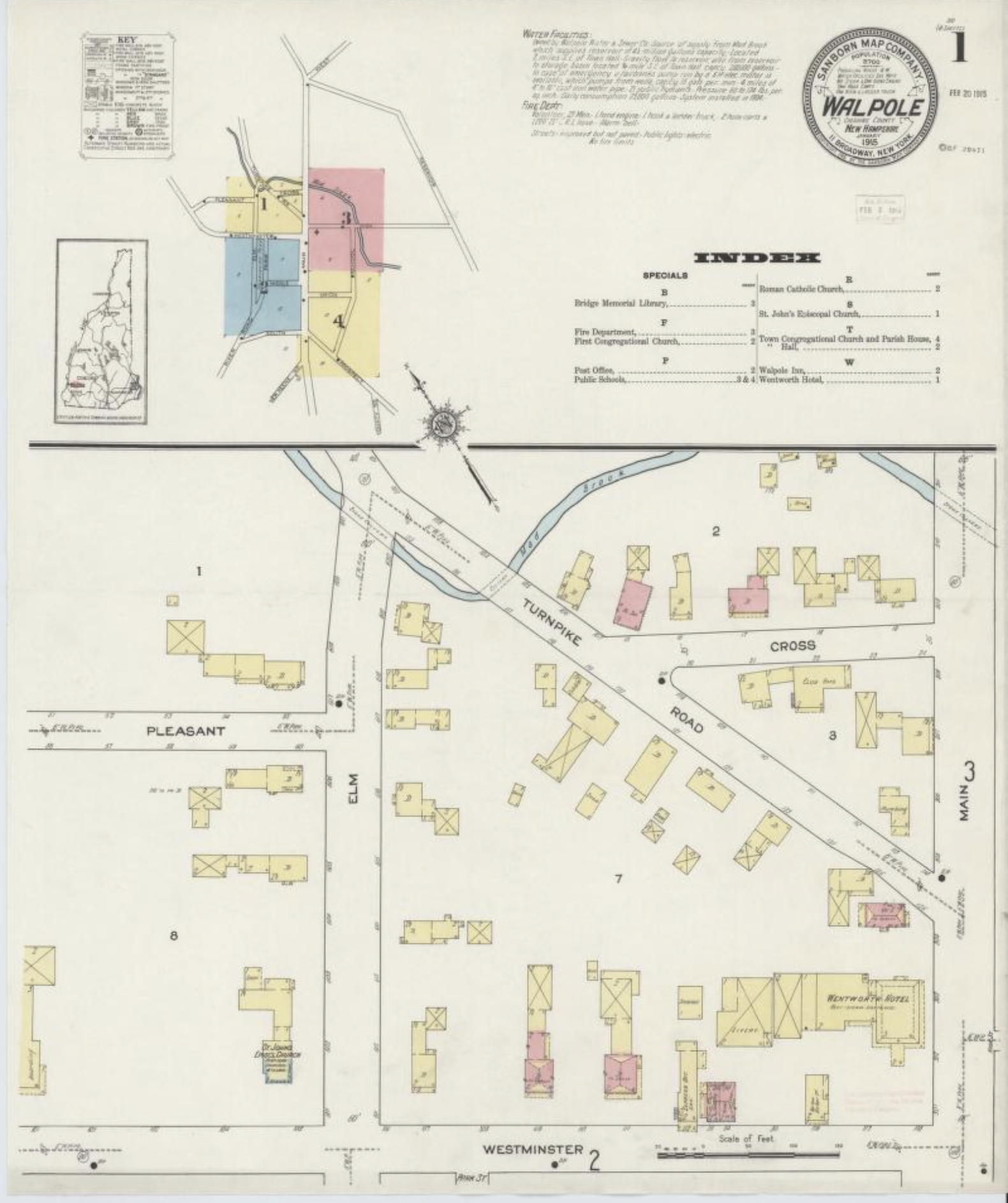
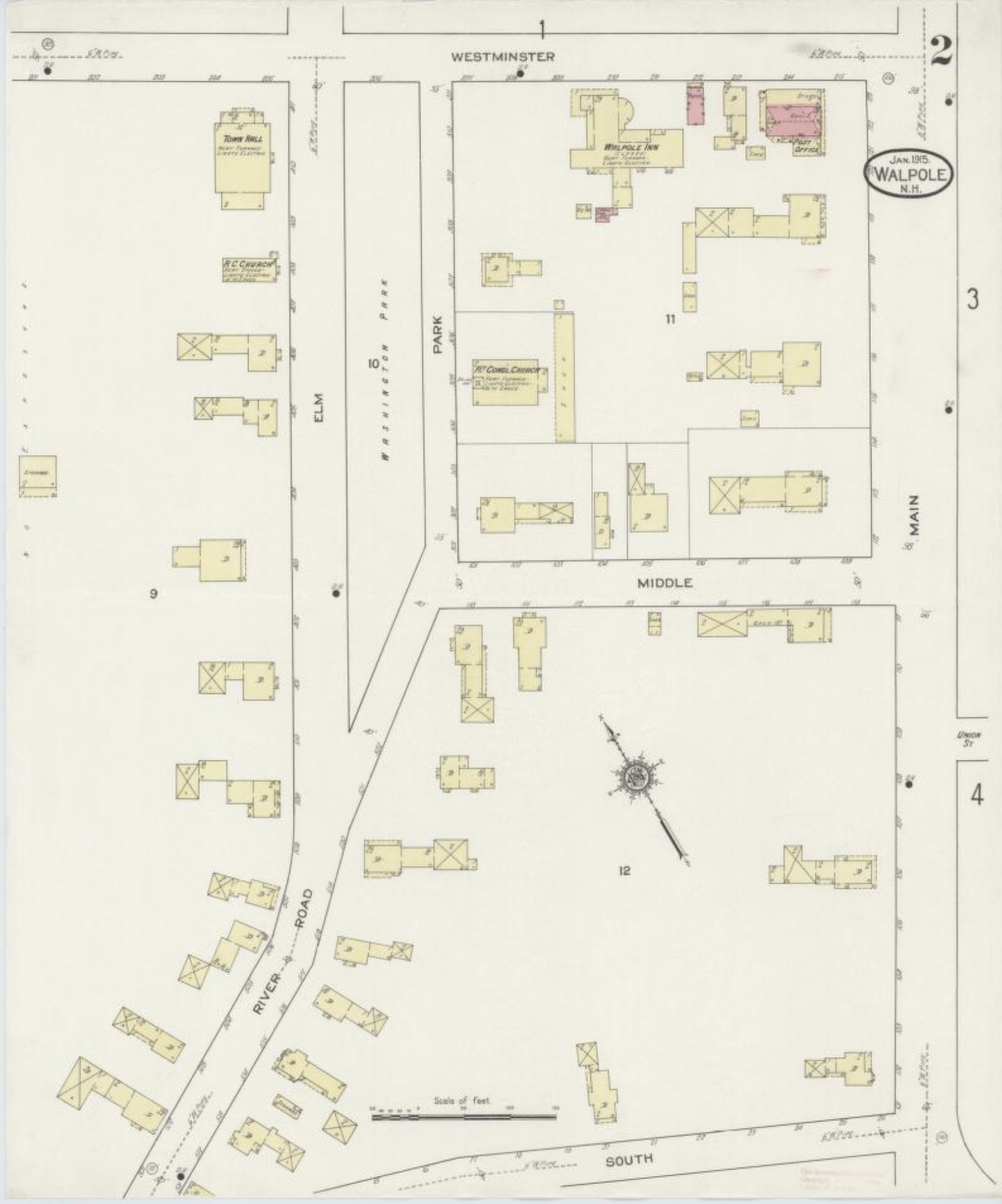
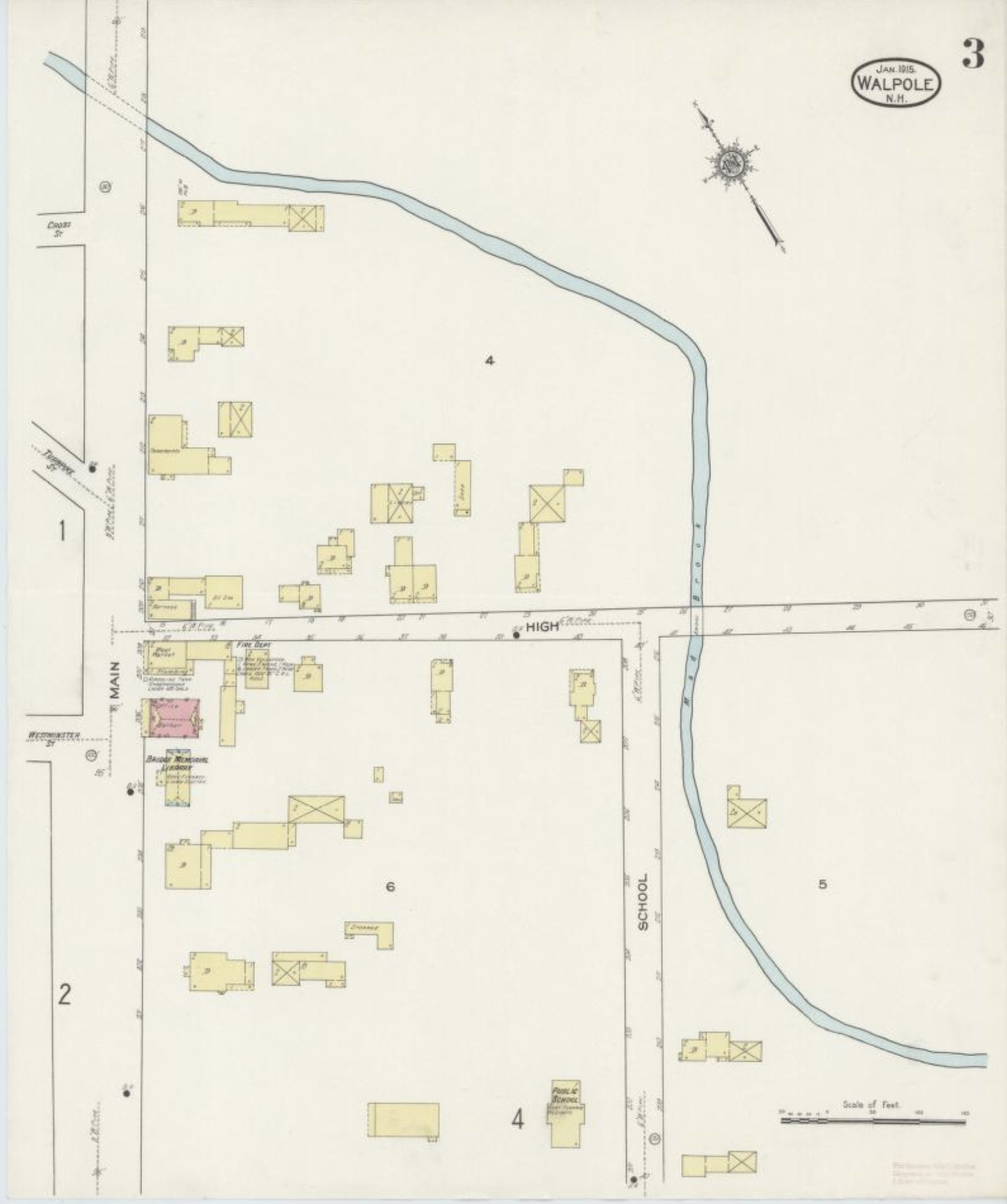
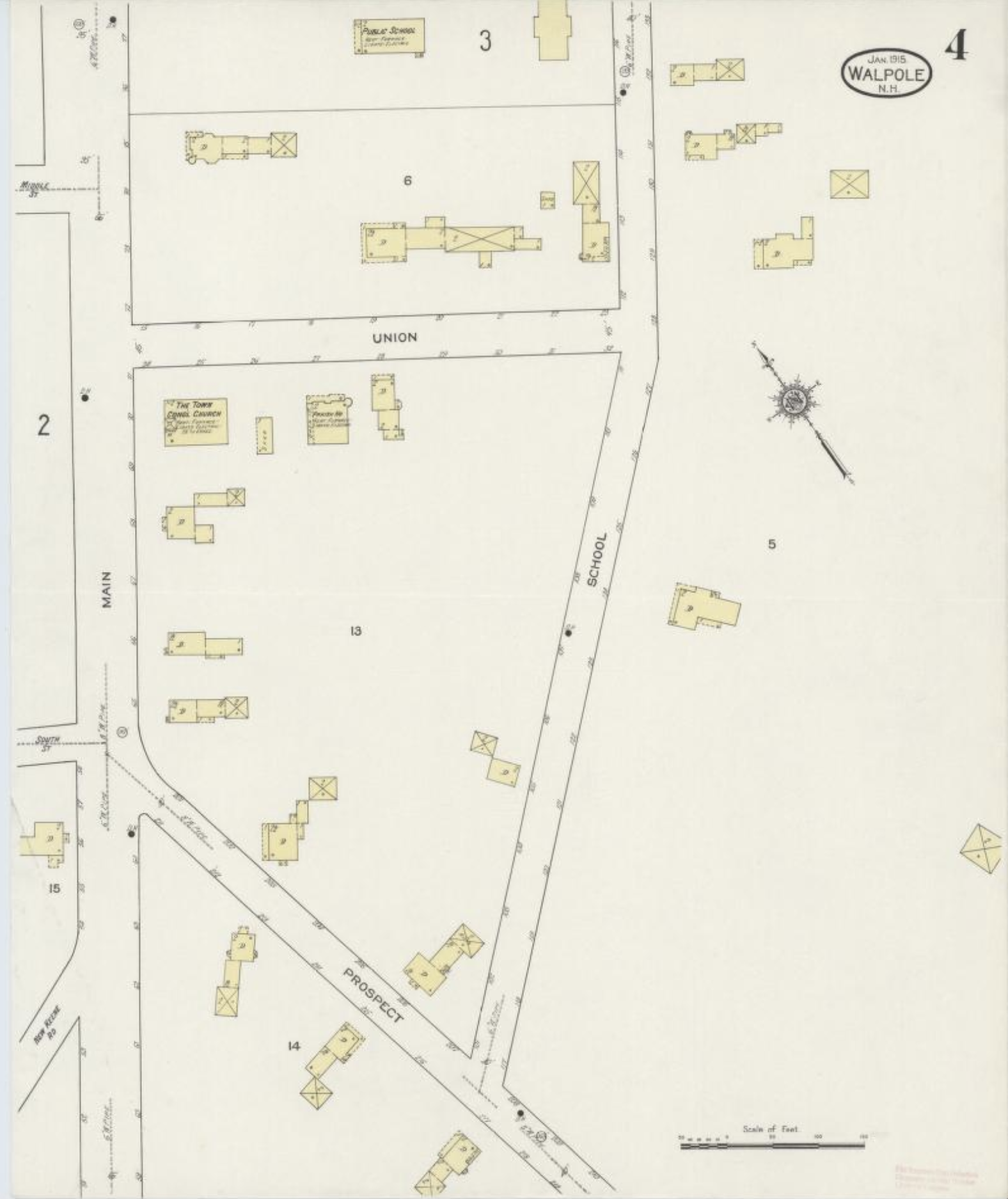
Sanborn Fire Insurance Map of Walpole, NH
Sanborn fire insurance maps are highly detailed and meticulously crafted maps of cities and towns across the United States, produced by the Sanborn Map Company from the mid-nineteenth century through much of the twentieth century. Originally designed to assist fire insurance companies in evaluating the risk and potential liability of properties in urban areas, these maps provided crucial information about building materials, structural details, property boundaries, and the locations of water sources and fire hydrants.
Covering approximately 12,000 cities and towns, Sanborn maps offer an unparalleled record of the built environment, capturing the evolution of urban and rural landscapes over many decades. They show not only the layout of streets and the arrangement of buildings but also specific details like the number of floors, the presence of basements, and the use of each structure. This level of detail makes Sanborn maps invaluable tools for historians, urban planners, architects, and preservationists, as they offer insight into the growth and development of American communities and how they have changed over time. Today, they are used extensively in historical research, urban archaeology, and the preservation of historic sites.
Sanborn Map Company, 1915